
Mars Document Register
Search by activity or form number. Download a fillable PDF in color or black and white, complete it, and send your saved copy to the HAE office.
Loading documents…
Submit a Completed Form
Download the edition you prefer, complete the fields, and save your PDF. Email the saved form and supporting documents to [email protected].
Use year–month–day for dates: YYYY-MM-DD (for example, 2026-11-18). Include the time zone when providing a time. Include the form number and your name in the subject. For site or zoning records, include the Mars map reference, coordinate convention, boundary information, and revision used.
Email the HAE officeAttach your saved files in your email application. Submission does not constitute approval.
Mars Surface Maps
The original six surface maps: global geography, zoning, region acreage, polar views, and subdivision references.
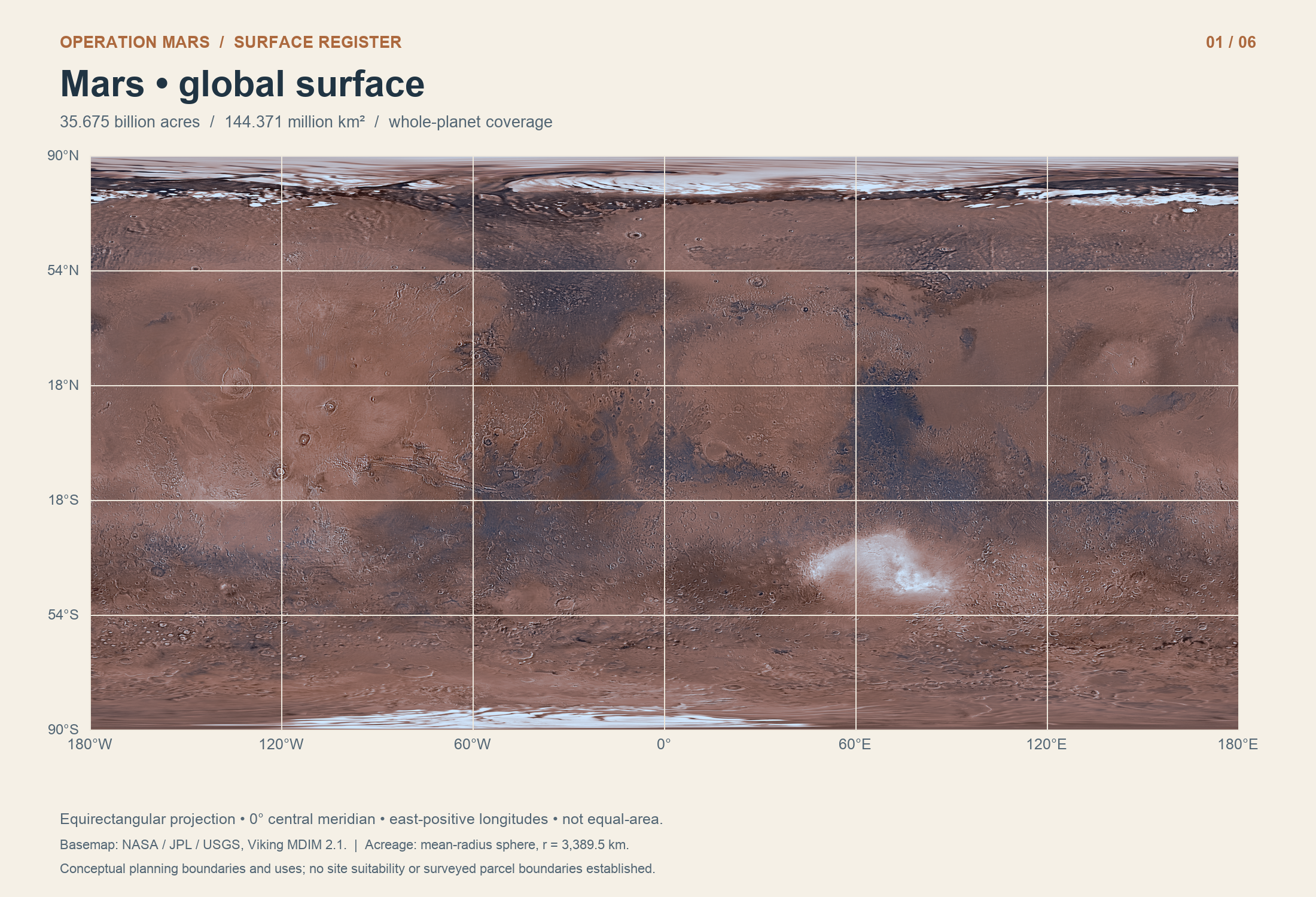
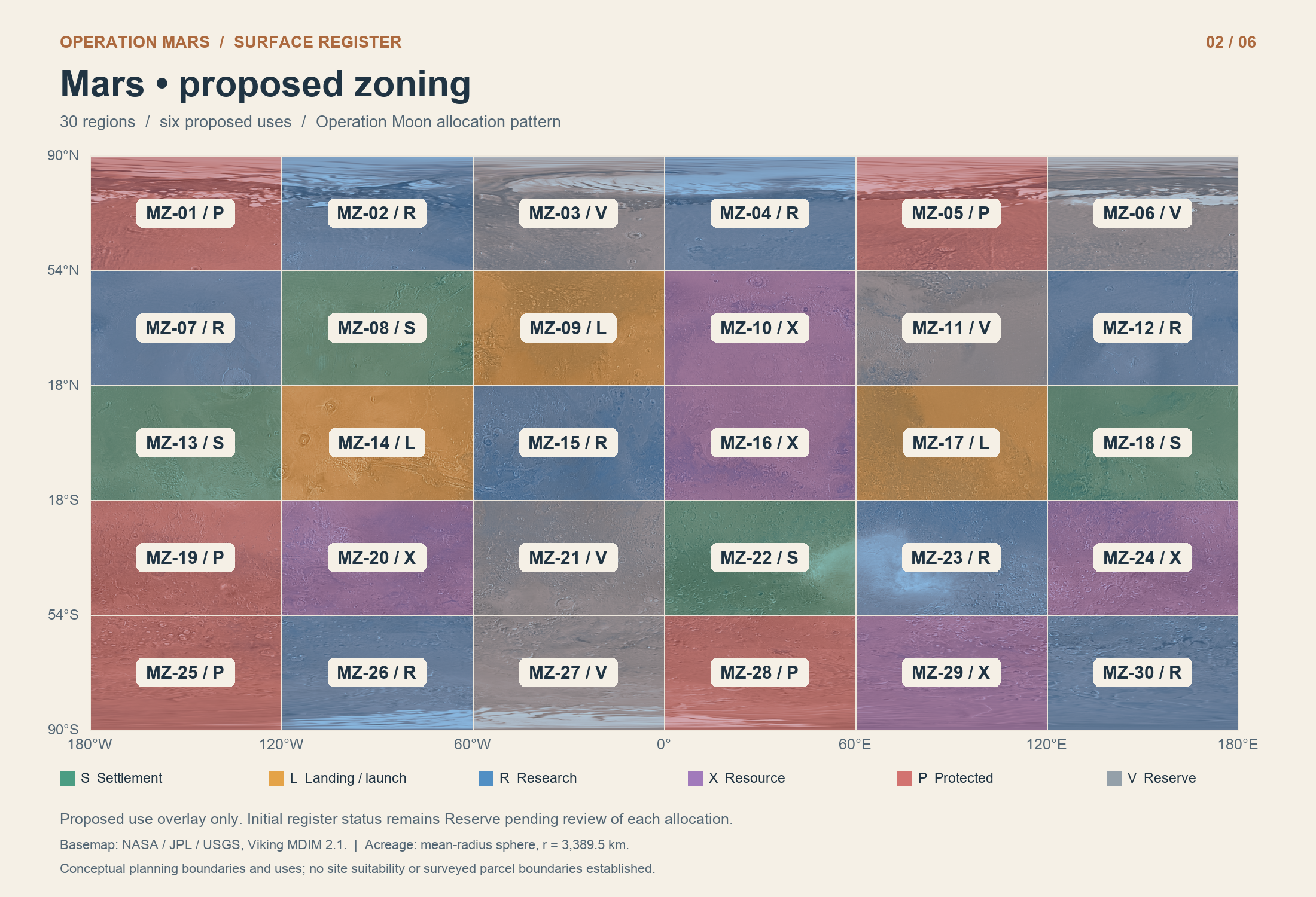
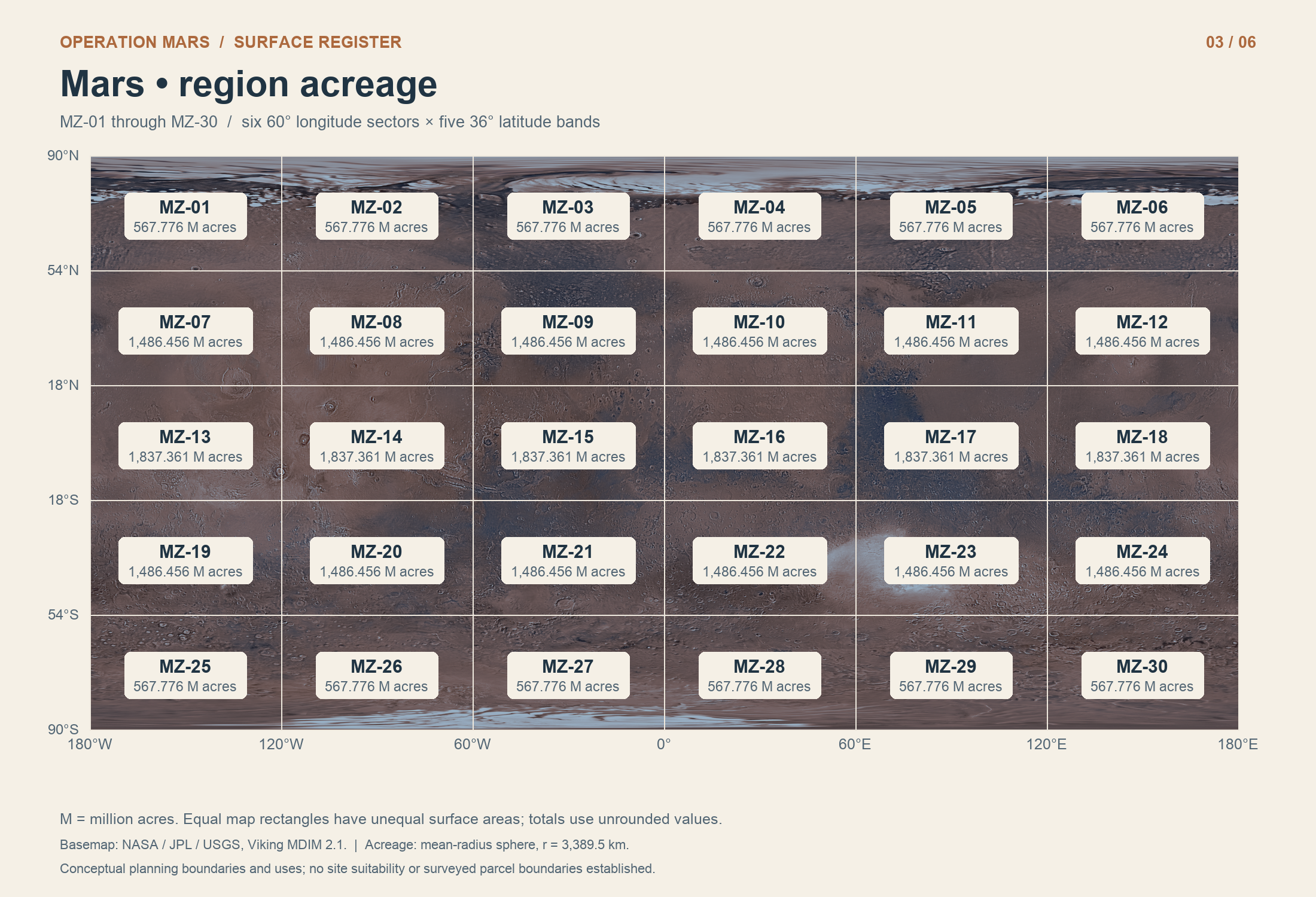
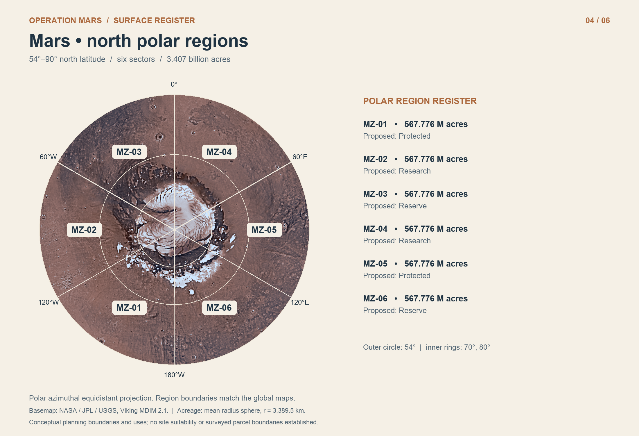
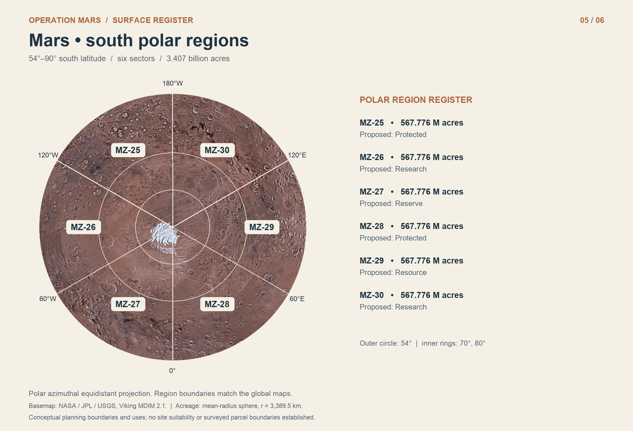
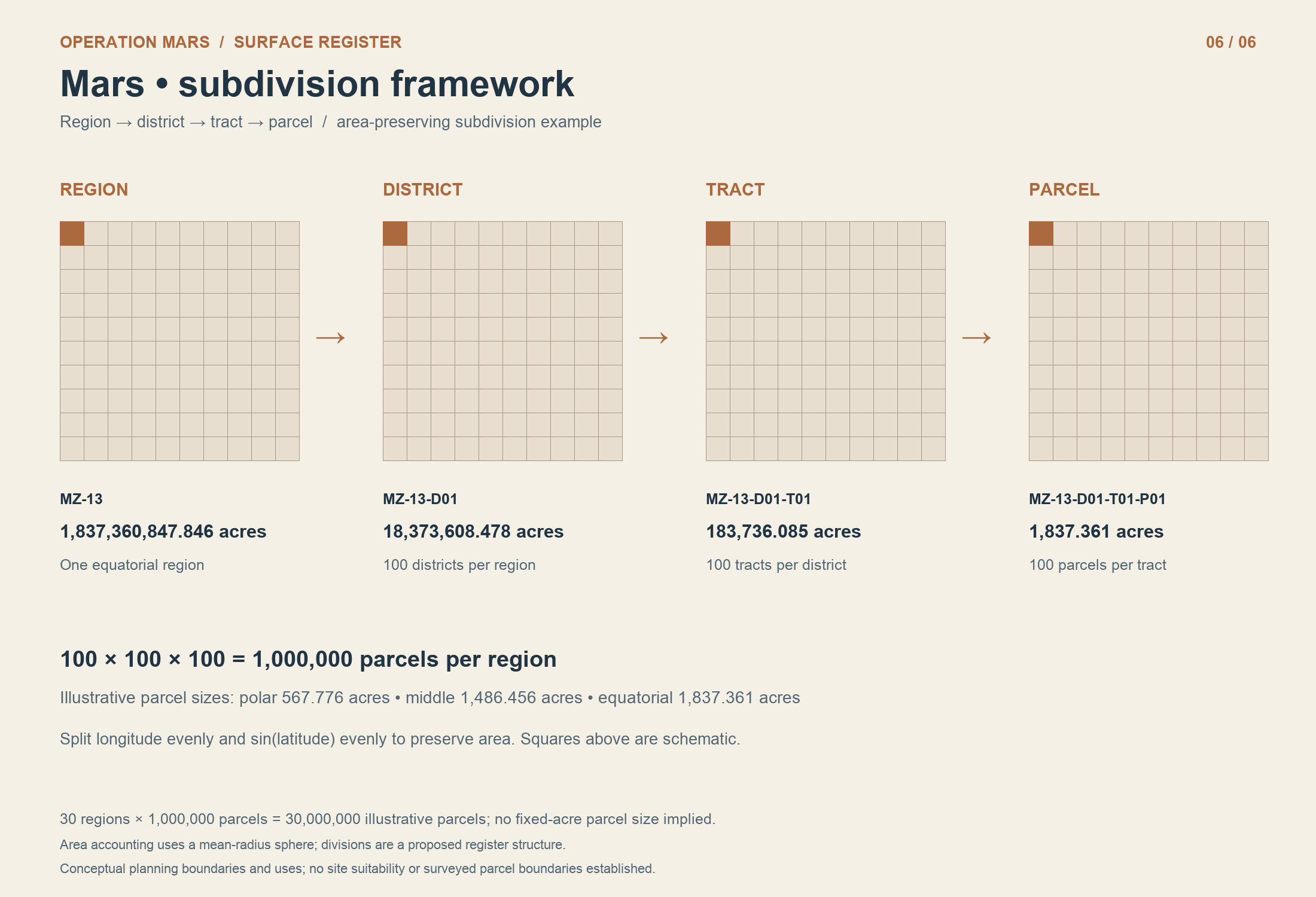
The 30 land-use reference regions form their own geographic layer. The allocation sectors below are a separate overlay. Download the region register.
Mars Allocation and Real Estate
Geographic allocation boundaries, the retained reserve, and Alexander Durchdenwald’s sales allocation.
Alexander Durchdenwald
US $20 per acre
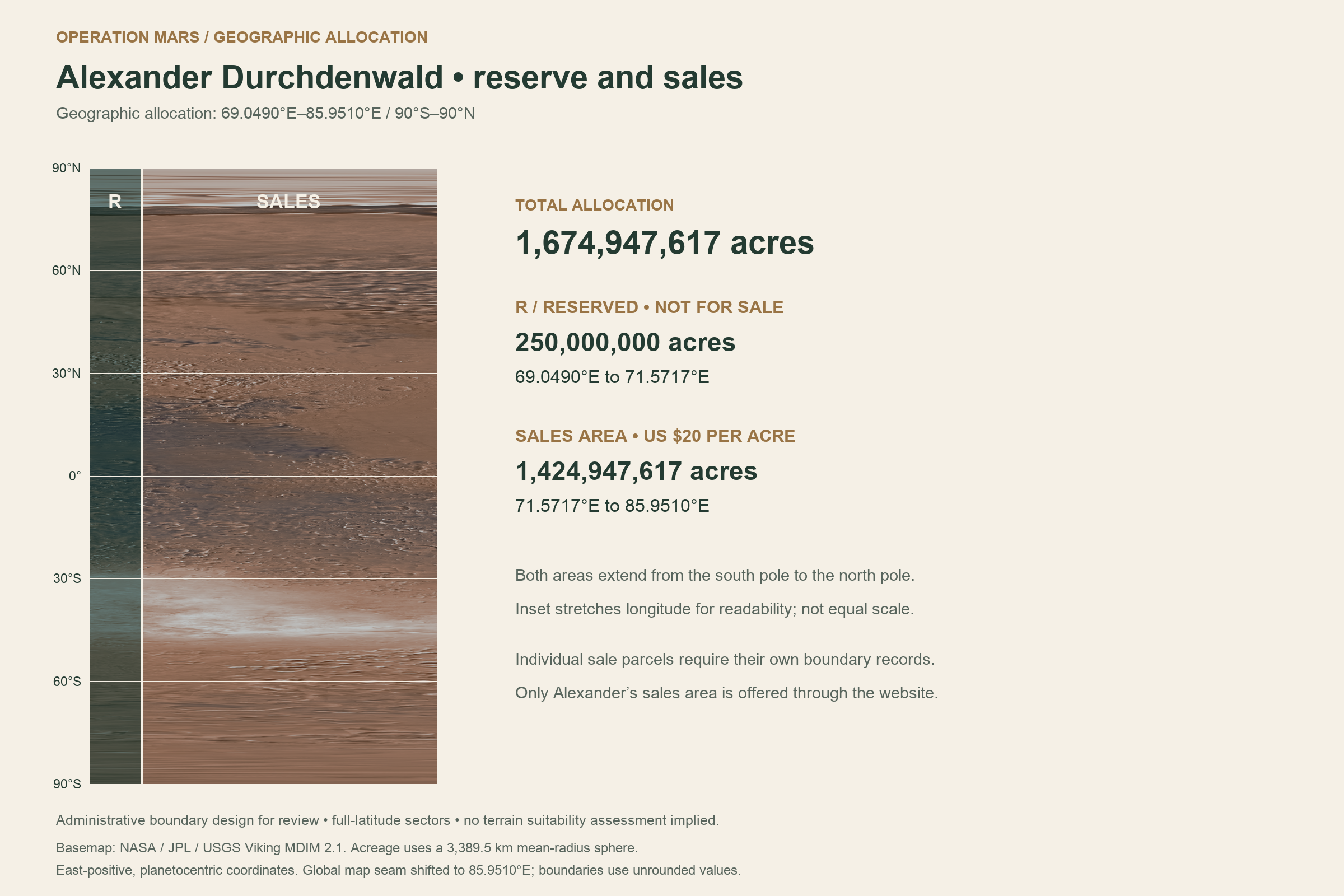
Approximately 1.675 billion acres in total (1,674,947,617 acres, rounded).
250,000,000 acres retained in reserve — not for sale.
Sales allocation after reserve: approximately 1,424,947,617 acres. Only Alexander’s remaining allocation is offered through this site.
Inquire About Acreage
The HAE office confirms available parcels, purchase terms, and individual parcel boundaries.
Inquire by emailUse HAE-MAR-022, Mars Land Purchase Application, when requested by the office.
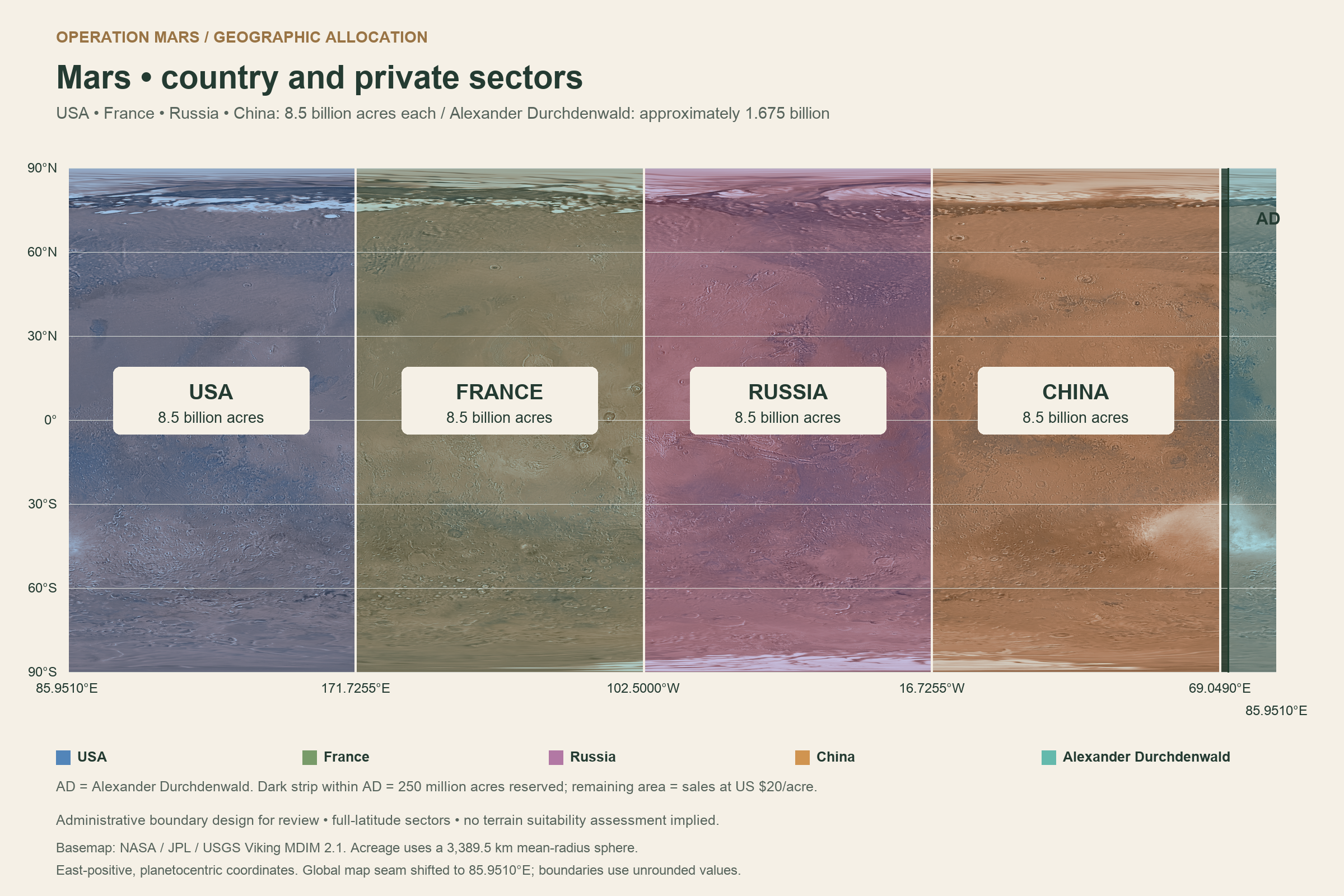
Alexander’s sector extends from 69.048955°E to 85.951045°E. All division lines remain straight north-south meridians.
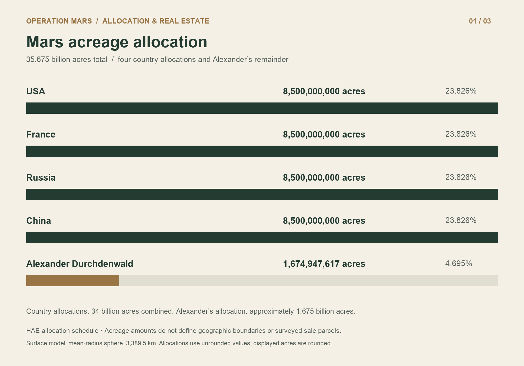
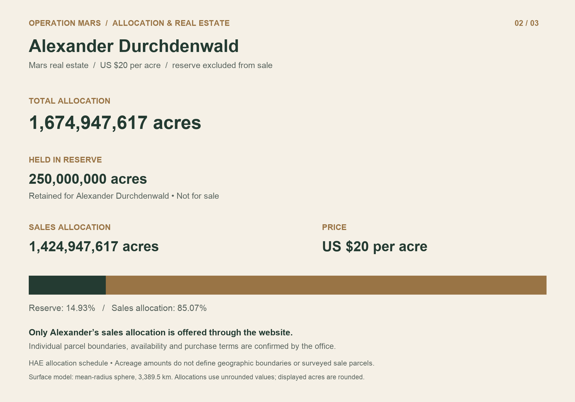
Allocation acreages and geographic boundaries
All sectors extend from 90°S to 90°N. Longitudes use east-positive coordinates: negative values lie west of zero. France extends eastward across ±180°, from 171.725522°E to 102.500000°W. The map seam is rotated to 85.951044°E so every sector remains a continuous rectangular strip. Displayed coordinates are rounded to six decimal places; acreage calculations use the unrounded boundaries.
| Allocation | Acres (rounded) | West boundary | East boundary |
|---|---|---|---|
| USA | 8,500,000,000 | 85.951045° | 171.725522° |
| France | 8,500,000,000 | 171.725522° | -102.500000° |
| Russia | 8,500,000,000 | -102.500000° | -16.725522° |
| China | 8,500,000,000 | -16.725522° | 69.048955° |
| Alexander Durchdenwald | 1,674,947,617 | 69.048955° | 85.951045° |
Within Alexander’s sector, the reserve extends from 69.048955°E to 71.571734°E; the sales area extends from 71.571734°E to 85.951045°E. West boundaries are included and east boundaries excluded. ±180° is one seam; the poles are shared boundary points with zero area.
Total surface: approximately 35,674,947,617 acres, using a sphere with mean radius 3,389.5 km. The 1.675-billion-acre figure is a rounded presentation of the remainder, not an additional allocation.
Country Allocation Sale Records
The HAE schedule assigns 8.5 billion acres each to the USA, France, Russia, and China. Those allocations are not sold through this website. Submit their sale records separately, including the allocation, seller, buyer, parcel reference, acreage, sale date (YYYY-MM-DD), and supporting documents.
Submit a sale record by emailThese maps describe the HAE allocation scheme and geographic boundary design. They do not establish externally recognized ownership, participation by the named governments, terrain suitability, or surveyed individual parcels.
About the Register
Mars forms and accompanying etchings issued by the Holy American Empire. Each document has its own identifier and illustration, with matching color and black-and-white editions.
Use the coordinate system, map source, date (YYYY-MM-DD), and revision requested by the form. Office decisions and supporting records are handled separately from submission.
Signed and Sealed Mars Declaration
Signed 2026-11-18 · HAE-DEC-001 · Ownership and land division of Mars
Original signed and sealed declaration — photograph (PDF)
Clean signed and sealed declaration (PDF)
Same declaration text, with signature and seal reproduced from the signed original.